Lumsden, le 14 Mars 2018
Chers famille et amis,
Nous espérons que vous allez tous pour le mieux et que la chaleur revient peu à peu. Ici, elle nous quitte lentement, chacun son tour !
C'est le coeur lourd que nous partions d'Akaroa. Heureusement, nous avons retrouvé quelques amis à Christchurch. Nous en avons profité pour tester plusieurs cafés très sympas et pu prendre des nouvelles de nos anciens collègues.


On se réchauffe dans un design industriel familier
Nous sommes maintenant prêts à découvrir l'île du Sud dont on nous a tant vanté la splendeur et diversité !
Nous commençons par le lac Tekapo, l'un des plus grands et profonds de Nouvelle-Zélande dont la renomée n'est plus à faire. Une fois "visité" la fameuse "église du bon berger" à son rivage, nous faisons une petite marche le long du lac. Nous faisons connaissance avec la faune terrestre locale : les lapins. Ce n'est que la première de nombreuses rencontres avec leurs terriers et leur petite queue blanche. Attention, les lapins sont une peste en Nouvelle-Zélande, ils ne sont pas "mignons" !

L'église au bord de l'eau

Les nuages approchent

Ça s'assombrit

Notre camping sur l'eau

Nous appellerons ça du Bush Art!
À quelques kilomètres de là, on retrouve le lac Punakaki, proche du Mont Cook. Sa taille et sa couleur sont très semblables à celles du Lac Tekapo. Cette fois-ci, avec le soleil qui l'illumine, on apprécie vraiment sa beauté. Sa couleur bleue est due à l'eau qui coule des glaciers proches et aux sédiments qui en tapissent le fond.

Le bleu du lac et le blanc du ciel en fond
Nous longeons le lac sous un ciel qui se charge peu à peu de nuages ; c'est mauvais signe pour apercevoir le toit de la Nouvelle-Zélande. Mais nous avons bon espoir ! Pour se mettre en jambe avant la grosse rando du lendemain, nous marchons toute l'aprem proche des montagnes et glaciers. Nous faisons connaissance avec les paysages montagneux, mais restons un peu sur notre faim, la grisaille n'aidant pas.


Les nuages ont décidé de nous cacher le Mont Cook !
Le lendemain, après une nuit des plus pluvieuses au pied du Mont Cook, le temps semble être plus clément et nous décidons d'entamer la marche vers la Mueller Hut dont on nous a parlé maintes fois. Au programme, 1000m de dénivelé positif sur 5 km. La première partie n'est faite que de marches ennuyeuses (1972 marches pour être exact) mais nous marchons ensuite sur de gros rochers avec plaisir, avant de découvrir la majestuosité des glaciers et montagnes environnantes. Quelques gros nuages nous empêchent de voir le Mont Cook mais la vue est tout de même splendide. Nous n'entrevoyons le haut du Mont Cook qu'une fois revenus au parking - ça valait bien le coup de monter ;)

Après 1972 marches, les nuages ne sont plus très loin. Allez, on continue !

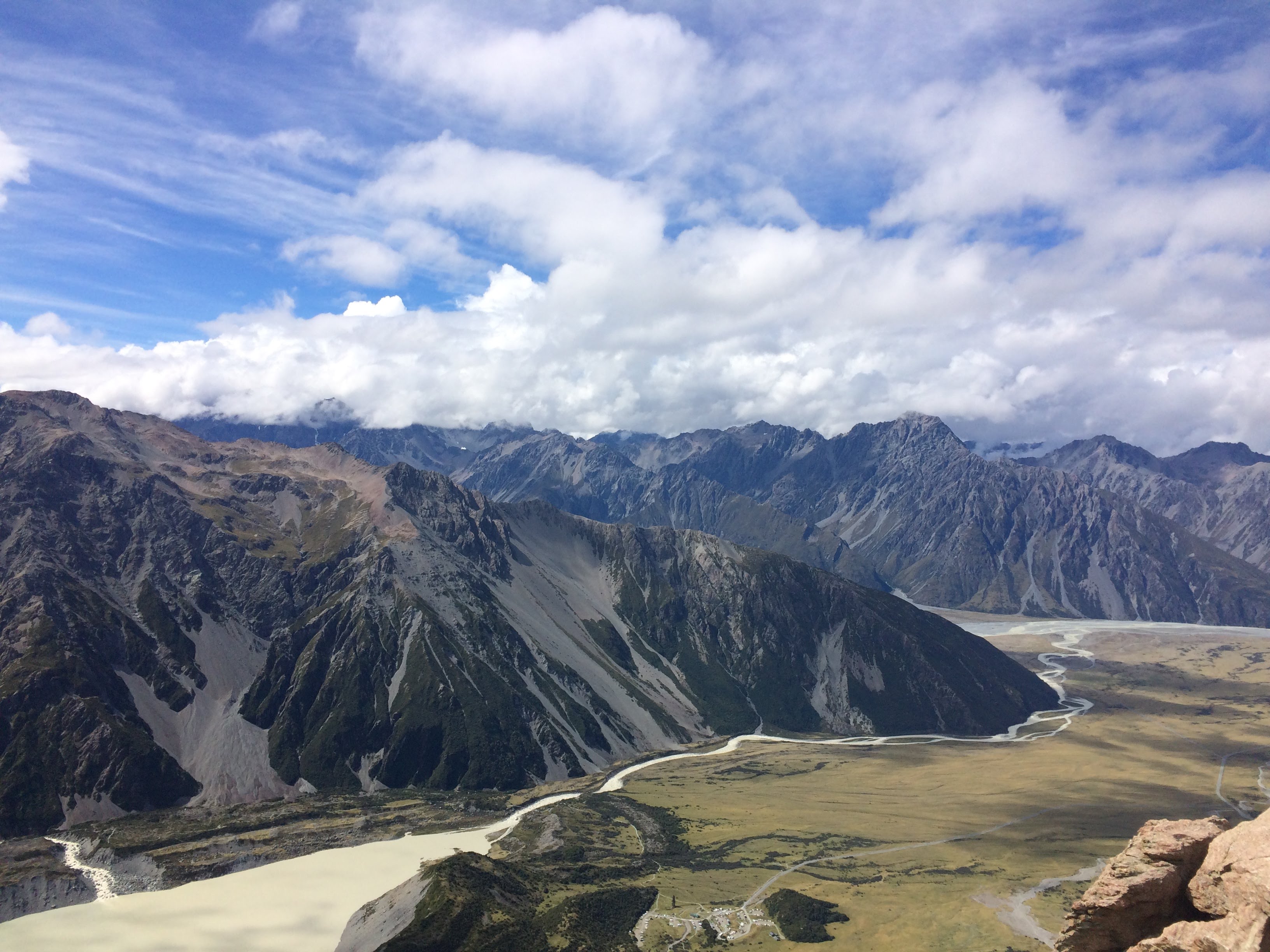
Vue sur la vallée et notre camping presque invisible en bas

On vous assure, le Mont Cook est juste derrière cette masse blanche !

Vue dégagée sur les glaciers

De gauche à droite : un marcheur solitaire, un arc en ciel et le glacier qui hurle
Après ces quelques jours dans les terres, nous reprenons le chemin de la côte, direction Oamaru et ses colonies de pingouins et otaries que nous connaissons déjà après nos semaines sur le Fox II. La petite ville est très mignonne et nous apprécions son petit port.


Petit arrêt obligé par Geraldine et son petit café


Escalade à Elephant Rocks

Oamaru
Nous poursuivons ensuite notre route vers le Sud pour aller voir de nos propres yeux la couverture de notre guide.
Les Moeraki Boulders sont des formations rocheuses rondes qui, avec l'érosion, se trouvent maintenant sur la plage et ne sont visibles qu'à marée basse. Le temps se gâte et c'est sous un temps brumeux que nous découvrons ces boules parfaites. Mystique ! Un autre style que celui de la photo du Petit Futé ;)

À la recherche d'une explication


La comparaison s'impose


Il ne faudra pas être trop difficile sur les photos de la faune locale
Quelle élégance !
Nous continuons notre route vers le Sud jusqu'à Dunedin, la ville la plus écossaise de Nouvelle-Zélande - et le prouve en nous accueillant sous la pluie. Ville jeune et dynamique avec plusieurs universités en plein centre et du Street Art partout dans la ville, cela nous donne une bonne raison pour flâner dans ses rues.

La gare


Notre meilleure photo de pingouins aux yeux jaunes ! et d'autres exemples de Street Art
Lorsque le soleil refait finalement surface, nous en profitons pour découvrir la belle péninsule d'Otago. Elle regorge (paraît-il) de pingouins à yeux jaunes et de petits pingouins bleus. On a eu beau chercher, on n'a vu que des otaries, des mouettes et des huitriers pie. Encore et encore... Mais la péninsule est magnifique et c'est sous un ciel radieux que nous parcourons ses plages et sa côte qui nous rappellent la Bretagne.

Une falaise et une eau superbe


La journée est radieuse et la péninsule paisible : que demander de plus ?!


Les otaries et lions de mer aussi profitent de cette belle journée


À gauche, deux huîtriers pie (un de nos oiseaux préférés) et à droite, une otarie camouflée
Avant de reprendre la route, il nous faut passer notre First Aid Certificate (certificat d'aide aux premiers secours) : Léo, car elle en a besoin pour un job la semaine d'après, et Baptiste, par curiosité. On apprend pas mal de nouveau vocabulaire et on réapprend les bases du secourisme ; tout ça avec un accent kiwi à couper au couteau !
Notre diplôme en poche, nous prenons la route vers les Catlins, la région la plus au Sud de la Nouvelle-Zélande, relativement délaissée des touristes car moins accessible. Nous nous y dirigeons avec d'autant plus de plaisir et y retrouvons Sarina, notre ancienne collègue du Fox II.


Nugget Point (on n'a pas trouvé le KFC...)

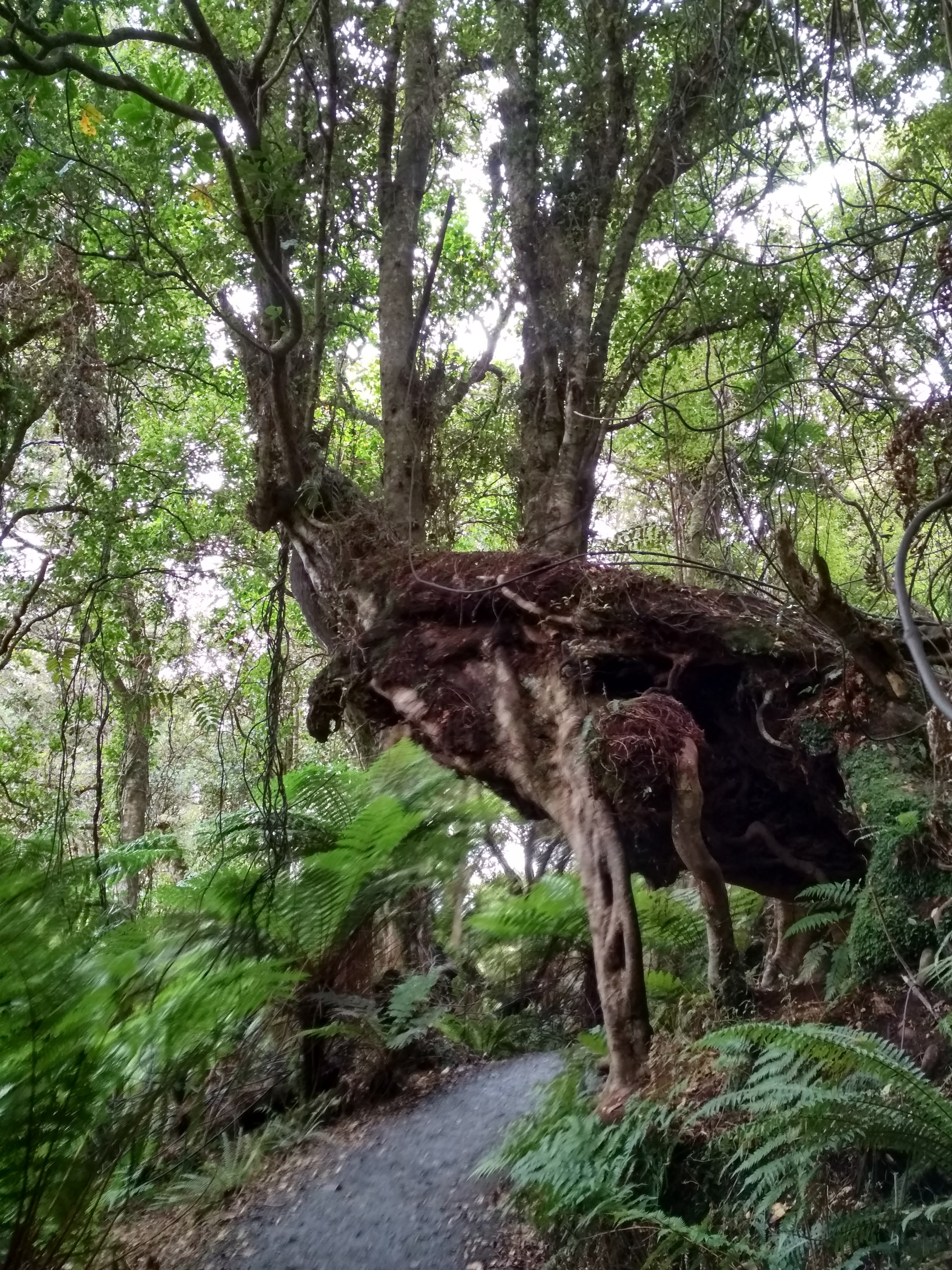
Verrez-vous ce que l'arbre essaie de nous dire ? (indice: AUS)

Jack's Blowhole : les vagues s'infiltrent sur plus de 50m pour creuser la pierre et faire un gigantesque souffleur - plus impressionnant à marée haute

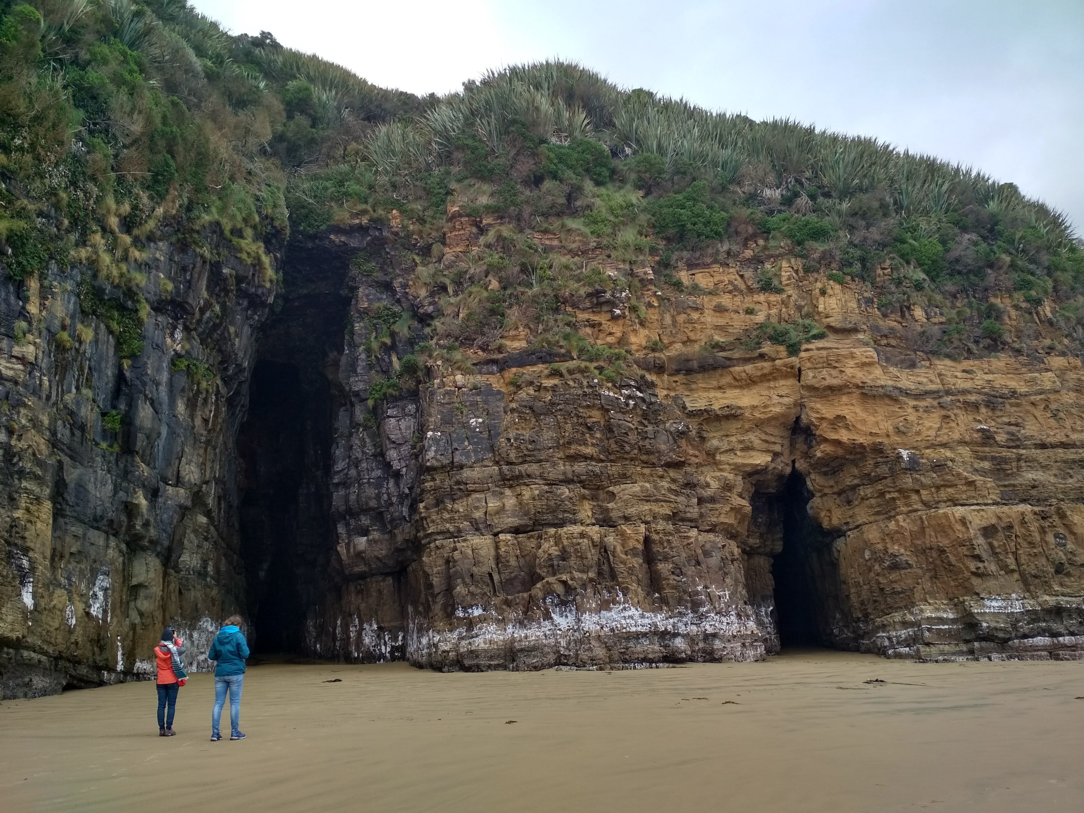
Les tunnels de Cathedral Cave se rejoignent au fond


L'océan continue à creuser la pierre chaque jour
La côte est magnifique : de superbes plages et de belles falaises qui les bordent. Nous y apercevons (en se cachant pendant 1 heure) aussi un groupe de pingouins à yeux jaunes qui rentrent après une journée de pêche : de loin, de très loin même. Il ne faudra pas faire son difficile pour les photos mais c'est déjà une victoire de les avoir vus.


Ce n'est pas un photo montage : ce lion de mer (un peu agressif) va lire le panneau d'avertissement

De grandes herbes, un lion de mer et, au loin, Stewart Island
Après avoir été aux points les plus au Nord et à l'Est de la Nouvelle-Zélande, passage obligé par le point (reculé) le plus au Sud de l'île. Rien d'extraordinaire, nous y retrouvons nos amis fidèles : les moutons et le vent !


Il reste encore du chemin avant d'atteindre le Pole Sud !
Après un passage éclair par Bluff (qui n'a rien de bluffant), la ville la plus au Sud qui nous donne tout de même une jolie vue sur Stewart Island, nous remontons tranquillement vers Queenstown et Glenorchy.

Nous avons fait du chemin depuis Cape Reinga

Devant nous, Stewart Island, l'île au sud de l'Île du Sud (vous suivez ?)
Queenstown est l'une des villes les plus actives : sa situation proche des montagnes et au bord d'un grand lac (Lac Wakatipu) en font une destination de rêve pour les skieurs en hiver et les amateurs de sensations fortes tout le reste de l'année. C'est là que, paraît-il, a été inventé le saut à l'élastique.

À quelques kilomètres de Queenstown, Kingston est notre première rencontre avec le lac Wakatipu
Nous ne faisons que la traverser pour aller vers Glenorchy où Léo doit commmencer un travail de guide de randonnées à cheval.


Les paysages alentours sont magnifiques. On surnomme Glenorchy "l'entrée du paradis"
L'expérience fut brève mais intéressante. Pour résumer, Léo a eu la chance de pouvoir monter à cheval pendant 3 jours mais s'est vite rendu compte que ce métier n'était pas fait pour elle. N'étant finalement pas indispensable car c'est la fin de la saison, nous décidons de continuer notre route vers le Sud pour rejoindre la région du Fiordland.


À à à la queue leu leu
Nous sommes maintenant à Lumsden, ville étape, dans un camping que nous connaissons déjà et aimons particulièrement pour ses Alpacas.

On évite les crachas
Nous vous embrassons tous fort !
Léonie et Baptiste


